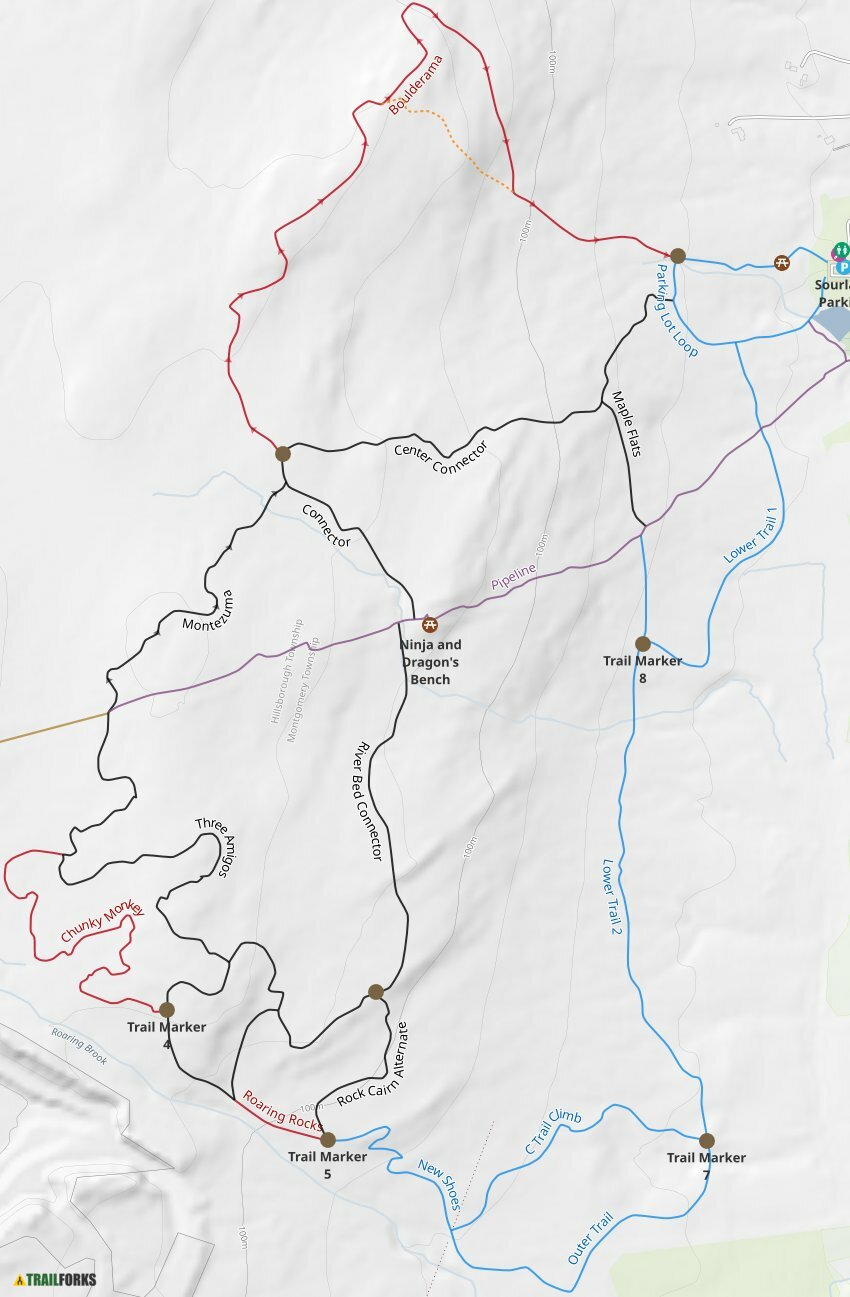
I clicked on the old trail map link and much to my surprise, the
online map has been updated based on the latest trail re-marking. It also looks like they moved/reduced the intersection marker numbers (on the map anyway, I hope they also physically changed them). Next time I'm down there I will verify. Not sure i want to change my
TrailForks names to match their map though, since we don't actually ride in the loops they have defined.
Sourland Mountain Preserve Mountain Bike, Hike, Trail Running trails near Hillsborough, New Jersey. 22 trails with 52 photos

www.trailforks.com
some people are still walking up the old fall-line trail to marker 5 rather than taking
new shoes.
The county map doesn't show it correctly.
I may take a rake up there and open up the switchback where the hikers cut is marked on new shoes.
There are a few more intersection makers that don't have ID#s on them yet.
The installer didn't do a great job of getting them in vertically. I'll take a pic.
I'd like to add a switchback at that boulder/tree feature above marker 5 -
it would clear space for the step down (send it!) coming down the trail,
and remove a steep section - we'll see.


/__opt__aboutcom__coeus__resources__content_migration__mnn__images__2016__03__trekker-antarctica-bd33749a73554b01ae8c61409824ac43.jpg)