


You are using an out of date browser. It may not display this or other websites correctly.
You should upgrade or use an alternative browser.
You should upgrade or use an alternative browser.
What WEIRD things have you found on your rides?
- Thread starter mtn
- Start date
jmanic
JORBA Board Member/Chapter Leader
Staff member
JORBA.ORG
Team MTBNJ Halter's
It's my Birthday!
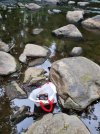
FTFY3 previously sealed beers down by the river
Potentially not polluting. Could just be keeping post ride/hike beers cool the natural way and will pack it out after the ride/hike. If it's there tomorrow, then the beers are yours.3 sealed beers down by the river
They were Miller lights. I'm not picky about my eating habits but I passedPotentially not polluting. Could just be keeping post ride/hike beers cool the natural way and will pack it out after the ride/hike. If it's there tomorrow, then the beers are yours.
Kaleidopete
Well-Known Member
ekuhn
Well-Known Member
Typical Chief not paying attention to his gear....
Walked into 6MR yesterday to scope out the reroute post Ida, and confirm we used the trusses to bridge the "wet" area - it isn't wet now...
I always wondered why the bridge (the vorhees sign) was so high up, so took a walk down to the washed out area.
Seems there is some historical brick and stone work there. 2024 historical funds applications are due in October, in case anyone wants to get this repaired.
This image shows a wall made of stone and the top of a brick arch. The hole on the bottom right is a collapsed part of the arch.
Most likely from the downhill failure of the structure to the right - next pic

The downstream arch was pushed out of place - likely causing the failure of the rest of the structure.
It should be "under" the root going across the picture. This creek bed goes down to the Six Mile Run.
Note more of the bricks a bit downstream.

Feels like we should somehow restore a path that might be 100 years old or more.
Anyone have contacts for funding work like this? @stb222
I always wondered why the bridge (the vorhees sign) was so high up, so took a walk down to the washed out area.
Seems there is some historical brick and stone work there. 2024 historical funds applications are due in October, in case anyone wants to get this repaired.
This image shows a wall made of stone and the top of a brick arch. The hole on the bottom right is a collapsed part of the arch.
Most likely from the downhill failure of the structure to the right - next pic
The downstream arch was pushed out of place - likely causing the failure of the rest of the structure.
It should be "under" the root going across the picture. This creek bed goes down to the Six Mile Run.
Note more of the bricks a bit downstream.
Feels like we should somehow restore a path that might be 100 years old or more.
Anyone have contacts for funding work like this? @stb222
rick81721
Lothar
Walked into 6MR yesterday to scope out the reroute post Ida, and confirm we used the trusses to bridge the "wet" area - it isn't wet now...
I always wondered why the bridge (the vorhees sign) was so high up, so took a walk down to the washed out area.
Seems there is some historical brick and stone work there. 2024 historical funds applications are due in October, in case anyone wants to get this repaired.
This image shows a wall made of stone and the top of a brick arch. The hole on the bottom right is a collapsed part of the arch.
Most likely from the downhill failure of the structure to the right - next pic
View attachment 195116
The downstream arch was pushed out of place - likely causing the failure of the rest of the structure.
It should be "under" the root going across the picture. This creek bed goes down to the Six Mile Run.
Note more of the bricks a bit downstream.
View attachment 195117
Feels like we should somehow restore a path that might be 100 years old or more.
Anyone have contacts for funding work like this? @stb222
Where exactly is this? May be best to stay away - what if the state decides it has historical significance and doesn't allow disturbing anything within a certain perimeter?
Where exactly is this? May be best to stay away - what if the state decides it has historical significance and doesn't allow disturbing anything within a certain perimeter?
it was the first left turn coming out of the rt 27 lot. Now has sticks across it.
Maybe there is an unexploded ordinance from WW1 under there too. or amelia or hoffa ?
rick81721
Lothar
it was the first left turn coming out of the rt 27 lot. Now has sticks across it.
Maybe there is an unexploded ordinance from WW1 under there too. or amelia or hoffa ?
First left?
Interesting stuff @Patrick. I don’t deal with anything related to preservation, unless it is historical related to the roadways.Where exactly is this? May be best to stay away - what if the state decides it has historical significance and doesn't allow disturbing anything within a certain perimeter?
First left?
there was a log pile on the right side of the trail, then a turn left. going straight led back up to the soccer fields over a rock plate. Maybe 400m in
That is either municipal or county I have no idea.Hey what's going on with the historical bridge rebuild on zion/Dutchtown-zion? They haven't done a thing in a year.
Karate Monkey
Well-Known Member
Maybe there is an unexploded ordinance from WW1 under there too. or amelia or hoffa ?
Bonaparte 😂
rick81721
Lothar
That is either municipal or county I have no idea.
Somerset county - found an update - the great flood last year caused the great pause
The flash flooding from Tropical Storm Ida on September 1st and 2nd damaged the three-span bridge, which was under construction as part of the rehabilitation project. Following the storm, the rehabilitation work was halted and developed viable solutions to rebuild the three span bridge and reconstruct the embankment along Dutchtown-Zion Road in the vicinity of the bridge. Our goal is rebuild the “Rock Brook Bridge” as it was and continue with our planned rehabilitation work per the initial plan concept.
[UPDATE 7-20-2022] We are continuing efforts to finalize the repairs plans, structural design and material fabrication documents, along with the environmental permit modifications and historic site project authorization for the expanded repair work. Construction activities will commence in August at the bridge site with debris removal / salvage of construction materials from downstream area, as well as recovery of historic bridge components. Major work at the site will continue once we have environmental permits and historic approvals.
County government for youSomerset county - found an update - the great flood last year caused the great pause
The flash flooding from Tropical Storm Ida on September 1st and 2nd damaged the three-span bridge, which was under construction as part of the rehabilitation project. Following the storm, the rehabilitation work was halted and developed viable solutions to rebuild the three span bridge and reconstruct the embankment along Dutchtown-Zion Road in the vicinity of the bridge. Our goal is rebuild the “Rock Brook Bridge” as it was and continue with our planned rehabilitation work per the initial plan concept.
[UPDATE 7-20-2022] We are continuing efforts to finalize the repairs plans, structural design and material fabrication documents, along with the environmental permit modifications and historic site project authorization for the expanded repair work. Construction activities will commence in August at the bridge site with debris removal / salvage of construction materials from downstream area, as well as recovery of historic bridge components. Major work at the site will continue once we have environmental permits and historic approvals.
I think you hit the nail on the head.Potentially not polluting. Could just be keeping post ride/hike beers cool the natural way and will pack it out after the ride/hike. If it's there tomorrow, then the beers are yours.