


You are using an out of date browser. It may not display this or other websites correctly.
You should upgrade or use an alternative browser.
You should upgrade or use an alternative browser.
Hartshorne Trail maintenance info
- Thread starter knobbyhead
- Start date
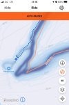
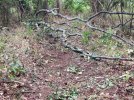
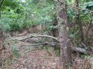
I added this as an issue in Trailforks. Accidentally uploaded the same photo twice and can't figure out how to delete.Tree down on the trail to the overlook by the devils elbow, broke off the small pieces, but didn’t have a saw.
Johnny Utah
Well-Known Member
This one deserves more than just a thumbs up, solid work! Thank you!Thanks for noticing. We spent about 4 sessions working on this connector and I'm happy with the results.
We rebuilt this connector two years ago, adding turns and drainage points. Overall it's still a bit too linear given the sandy soil which is prone to erosion, but I did not want to take land for a proper reroute with grade reversals given the delicate native plants in the area.
The alternative is more engineered trail within the existing footprint to drain water and have the trail hold up. Basically every turn (I think there are 4?) down the hill follows a formula. Grade Dip/Inslope/Grade Dip.
This creates a more sustainable downhill and makes for a better trail experience.
View attachment 243115
View attachment 243116
View attachment 243118
Going into the last turn required some rock moving to set the turn up and complete the radius. These guys spent about 1.5hrs getting this guy and smaller slabs into place. I rode it afterwards and it was man hours well spent, the arc was perfect and set me on a great line into the lower turn. I worked on armoring the straight line in between the turns to counteract brake bumps and erosion which forms on trails this steep with sandy soils. We use soil to fill in the cracks around the rocks to lock everything in place. After a couple of rains the rock will become exposed and enhance the look of the trail.
View attachment 243124View attachment 243126View attachment 243128
Thanks to the volunteers who worked on this during the hottest point in the summer. Ken, Brian, Larry, Roland, Andy, @knobbyhead , Steve and Jorba rep @don.
Trail work is a labor of love, if you love trails then volunteer locally. If you can't make the Monday 9am-12pm sessions at Hartshorne then make it a point to volunteer at least 3x a year at another park when you can.
Hartshorne is now a recognized Jorba chapter. Becoming a Jorba member helps Hartshorne as well as other parks. It gives mtbers a collective voice we need to let land owners know who we are and helps insure access to trails we love. Join now.

Today we finished up repairs/reroute on Rocky Point Trail. We started this in the beginning of August, near the top of the Overlook.

The worst part of this section was all the sand at the bottom of the hill. To correct this erosion we added grade dips up top, to divert water off the trail.
Basically we hogged out 1'+ of soil in a low point and graded to it. Cut and fill to create dip, put leaves/organics back to define trail and give it a finished look. We did 6 or 7 of these.


Further down the erosion was worse at a steep section, we added a grade reversal reroute.
Digging grade dip before adding grade reversal.

The old line went downhill to the left. We put reroute in, turning right and uphill for our grade reversal.

While building this, closing the old line was as important as building new one. We transplanted plants and moved organics from new line onto the old one. The drought has been hard on our transplanting, but at least the organics are there for recovery.
Stripping topsoil and organics off of new line and filling in the old line.


The work we did in August up top got some rain on it and compacted nicely. The newer sections we did near the bottom need rain to pack, but it's rideable. We'll go back and make some tweaks once we get some rain on this.
I normally climb this trail, but after the work, I make it a point to go down it, it flows nicely.
Thanks to the crew who shows up every Monday to dig. If you can't make Monday mornings at 9am, come out to Perrineville on Saturday 10/12. All this fun you're having ain't for free. 😁
Larry, @ChrisRNC , @don , Brian, @knobbyhead , Ken, Roland, Andy, Austin, @smann .

The worst part of this section was all the sand at the bottom of the hill. To correct this erosion we added grade dips up top, to divert water off the trail.
Basically we hogged out 1'+ of soil in a low point and graded to it. Cut and fill to create dip, put leaves/organics back to define trail and give it a finished look. We did 6 or 7 of these.
Further down the erosion was worse at a steep section, we added a grade reversal reroute.
Digging grade dip before adding grade reversal.
The old line went downhill to the left. We put reroute in, turning right and uphill for our grade reversal.
While building this, closing the old line was as important as building new one. We transplanted plants and moved organics from new line onto the old one. The drought has been hard on our transplanting, but at least the organics are there for recovery.
Stripping topsoil and organics off of new line and filling in the old line.
The work we did in August up top got some rain on it and compacted nicely. The newer sections we did near the bottom need rain to pack, but it's rideable. We'll go back and make some tweaks once we get some rain on this.
I normally climb this trail, but after the work, I make it a point to go down it, it flows nicely.
Thanks to the crew who shows up every Monday to dig. If you can't make Monday mornings at 9am, come out to Perrineville on Saturday 10/12. All this fun you're having ain't for free. 😁
Larry, @ChrisRNC , @don , Brian, @knobbyhead , Ken, Roland, Andy, Austin, @smann .
don
Well-Known Member
Monday we had a great group do some fine tuning on the re-route that was mentioned in the Hartshorne Conditions thread (https://www.mtbnj.com/forum/threads/hartshorne-huber-conditions.22158/post-1283037)
This is a section of trail that Iggy laid out and the trail volunteers cut out to bring users around a very blown out section of Cuesta Ridge (near where it meets the intersection of Laurel Ridge and Grand Tour).
This TM we hand dug 3 grade dips on the reroute while Iggy was in the Bobcat doing massive remediation on the Cuesta Ridge trail.

Steve M, Chris, Larry and UK Steve (oh and Bob's dog lol)

All 3 grade dips in progress.

Larry and Roland on the 3rd grade dip. Those guys dug a massive trench and we used that material to create the rise. Between the 2 water should shed very well off the trail for years to come. We gave it some bank/slight inslope on the tail edge to help guide people around the bend.

3rd grade dip looking up trail. Roland is well over 6 ft and standing in the drain trench they cut out - so it shows it's pretty deep. The guys backfilled with duff and then leaves so it barely looks like we touched anything. Knobby is working on the throat of the grade dip. Giving it that special shape where the water drains but it isn't too outsloped so traffic doesn't have too little traction.

3rd grade dip looking uphill at the end of the TM. This crew works so fast that we were done with this before noon and a few of the guys moved more organics into the old section of trail so things can start growing back.

Downhill view of the 2nd grade dip and slightly in-sloped turn after it. Many barrows of dirt were used to make them and where they were excavated from will act as a catch basin for downhill water flow. Again with duff and leaves on it the section looks barely touched even as you walk by it. Kind of a shame as the holes these guys dug were substantial!
I believe the next step is to continue on with a slight reroute on Laurel Ridge up to the intersection. That section of trail is eroded badly and Iggy laid out a nice plan for a great solution to fix it. This part of Hartshorne gets a lot of traffic so it will be good to get it dialed in.
This is a section of trail that Iggy laid out and the trail volunteers cut out to bring users around a very blown out section of Cuesta Ridge (near where it meets the intersection of Laurel Ridge and Grand Tour).
This TM we hand dug 3 grade dips on the reroute while Iggy was in the Bobcat doing massive remediation on the Cuesta Ridge trail.
Steve M, Chris, Larry and UK Steve (oh and Bob's dog lol)
All 3 grade dips in progress.
Larry and Roland on the 3rd grade dip. Those guys dug a massive trench and we used that material to create the rise. Between the 2 water should shed very well off the trail for years to come. We gave it some bank/slight inslope on the tail edge to help guide people around the bend.
3rd grade dip looking up trail. Roland is well over 6 ft and standing in the drain trench they cut out - so it shows it's pretty deep. The guys backfilled with duff and then leaves so it barely looks like we touched anything. Knobby is working on the throat of the grade dip. Giving it that special shape where the water drains but it isn't too outsloped so traffic doesn't have too little traction.
3rd grade dip looking uphill at the end of the TM. This crew works so fast that we were done with this before noon and a few of the guys moved more organics into the old section of trail so things can start growing back.
Downhill view of the 2nd grade dip and slightly in-sloped turn after it. Many barrows of dirt were used to make them and where they were excavated from will act as a catch basin for downhill water flow. Again with duff and leaves on it the section looks barely touched even as you walk by it. Kind of a shame as the holes these guys dug were substantial!
I believe the next step is to continue on with a slight reroute on Laurel Ridge up to the intersection. That section of trail is eroded badly and Iggy laid out a nice plan for a great solution to fix it. This part of Hartshorne gets a lot of traffic so it will be good to get it dialed in.
I rode this afterwards, the radius & inslope really helps to turn at speed .
Weekly Monday trail sessions are happening at Hartshorne from 9am-12pm, all are welcome to come and give back.
We recently completed a reroute of lower Grand Tour, this is the area near the renovated open field location.
The old line was washed out at the bottom. We came in with some grade reversals to shed water. Two sessions were spent clearing invasives(multi-flora rose, green briar, bitter sweet vine) and two sessions were spent on the tread.
If you cant help out on Mondays, please come out to help with the new trail build at Marlboro. Our next one is this Saturday(4/11) from 9am-12pm. Park at 546 Newman Springs rd Marlboro.
We just wrapped up a rock armoring project on the start of Rocky Point near the kiosk. This is a problem area that gets a lot of water flow from the parking lot. We've worked on this several times over the years, every time we do better.
Back in 2009 we had a Jorba session to repair the erosion in this location. We put a grade dip in and Frank found a large rock to reinforce the soil holding back the water runoff.


This held for a few years but it wasn't long before it looked like this again.

I came in with a group of volunteers in 2022 and built this area up with soil. This kept water from coming down the trail...for a few years.

Earlier this year I saw signs of water runoff making its way down the trail. This would only get worse so I designed a grade dip made out of rock and armored the start of the trail with the Monday crew.
Step one was too dig gutter and set rock into it.

Then we raise and armor the tread above the gutter, similar to a grade dip. Its hard to see in the photo below, but there is a dip and a high point.

Once we have a high point we set rock into grade going down the hill. Don is standing on the high point, the gutter is behind him and the grade comes down the hill in front of him. Oh and that light colored rock in front of him is the bluestone Frank found on site in 2009 and used to reinforce the grade dip that was built. All the other rock is local peanut stone, except for Franks stone.

Please do more for trails then like this post. Sign up to volunteer and be a Jorba member.

Back in 2009 we had a Jorba session to repair the erosion in this location. We put a grade dip in and Frank found a large rock to reinforce the soil holding back the water runoff.
This held for a few years but it wasn't long before it looked like this again.
I came in with a group of volunteers in 2022 and built this area up with soil. This kept water from coming down the trail...for a few years.
Earlier this year I saw signs of water runoff making its way down the trail. This would only get worse so I designed a grade dip made out of rock and armored the start of the trail with the Monday crew.
Step one was too dig gutter and set rock into it.
Then we raise and armor the tread above the gutter, similar to a grade dip. Its hard to see in the photo below, but there is a dip and a high point.
Once we have a high point we set rock into grade going down the hill. Don is standing on the high point, the gutter is behind him and the grade comes down the hill in front of him. Oh and that light colored rock in front of him is the bluestone Frank found on site in 2009 and used to reinforce the grade dip that was built. All the other rock is local peanut stone, except for Franks stone.
Please do more for trails then like this post. Sign up to volunteer and be a Jorba member.