Allamuchy North Conditions

when both sides of the cut are going to fall, i'll support one side with something handy, and angle the cut on purpose so it can fall away.

Successfully clearing something twice as big as the bar is very satisfying!!!!
well done, and TY.
Thanks. My techniques continue to evolve.. Constant learning with this. Happy to say I don't get my bar horribly stuck every 5 minutes anymore. LOL.
 
IMG_1690.jpeg
IMG_1691.png

Tree down across trail - Wavin Willy - cranberry ledge road access. Not far in from parking.
 
If you want a “quick” loop, I’d park here:


This gives you the easiest access to orange, cardiac (purple), cardiac bypass, Rollie pollie, candy ass, and the new trail. It’s more of an enduro-style ride than a loop, though. You’ll start with a 400-500 foot vertical climb no matter which way you climb up from that lot.

Shorter loop from that lot:

And the quickest way to add lumpy bumpy to the ride:
 
I've only ridden here with the mtbnj group rides. Where should I park for a quick 2 hr loop?
Meant to use the reply feature to answer your question, see my post above! It’s pretty full of leaves right now but they’re getting packed down on the more popular trails, slowly but surely. Enjoy!
 
Hard day today. The leaves were pretty brutal on most of the trail that I did. Yellow, parts of red and some of blue weren’t too bad. Most of the connectors and legit trails were impossible to read and slow going.
Didn’t get over to candy ass.
 

Attachments

  • IMG_5001.jpeg
    IMG_5001.jpeg
    165.3 KB · Views: 100
  • IMG_4994.jpeg
    IMG_4994.jpeg
    197.4 KB · Views: 105
Did a quick loop up Pebble and around to Red back to Waterloo lot. Standing puddle at start of Pebble but otherwise ok. There was a tree down towards the Highlands split/top. Standing water in a few spots but overall not too bad.
 
Started from the tranquility lot. Cardiac ditch is eroded with some soft spots and standing water. Went over towards freaking middle but large tree blocked with lots of water. Cardiac bypass is fine and the new flow trail is pretty good with the exception of a tree still blocking. Orange is okay.
 
Started from the tranquility lot. Cardiac ditch is eroded with some soft spots and standing water. Went over towards freaking middle but large tree blocked with lots of water. Cardiac bypass is fine and the new flow trail is pretty good with the exception of a tree still blocking. Orange is okay.
I'm tracking these two. Do the waypoints on my map approximately match the location of the trees you just mentioned?
 

Attachments

  • Screenshot_20231222-171214.png
    Screenshot_20231222-171214.png
    157 KB · Views: 76
Lots of spots on white throughout the park where water has overtaken the trail. It’s kinda fun to ride through, I can’t lie, but obviously isn’t ideal for a trail’s long-term survival/erosion. These two pictures are from near the exit of dans trail/ice cream.
 

Attachments

  • 15E4A65F-ED9F-4A85-A4EB-03BE860CCA39.jpeg
    15E4A65F-ED9F-4A85-A4EB-03BE860CCA39.jpeg
    190.3 KB · Views: 85
  • 7CAEFD45-01B8-422E-9594-E93F1083FC23.png
    7CAEFD45-01B8-422E-9594-E93F1083FC23.png
    600.6 KB · Views: 97
Lots of spots on white throughout the park where water has overtaken the trail. It’s kinda fun to ride through, I can’t lie, but obviously isn’t ideal for a trail’s long-term survival/erosion. These two pictures are from near the exit of dans trail/ice cream.
Look like candidates for my trusty "grab a stick and make a nick"
 
Look like candidates for my trusty "grab a stick and make a nick"
I gotta start riding with a stick every time I go then 😂 truly a solid 30% of the white trail from tranquility to cardiac bypass looks like that. I didnt ride it between dans trail and cardiac but I can only assume that the common suspects for holding water are looking pretty bad there too.
 
I'm tracking these two. Do the waypoints on my map approximately match the location of the trees you just mentioned?
This is the one on the new flow trail, it's approx 0.3 mile down from it's junction with Ditch/Cardiac. Somone's made a start on it. There's another small one nearby that can be handled with a folding saw.

cVhhHIRR7IAAbudjz_DZap8g0S1NMsY2fN-rzqV7OUs-2048x1536.jpg
 
Old parts of White are highly susceptible to pooling (and running) water. There's been some really good work done over the past few years and we've been lucky - that really long rock bridge by the White/Yellow intersection wasn't built because that area is normally dry like it has been the past couple of years.
 
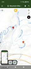
Did a bunch today. White was wet in many spots with running water in a few. The rest of what I did, red, half of blue, a bunch of connectors, lumpy, yellow…we’re all pretty much okay. Some splashes here and there but not really mud and certainly not running water for a trail.
Yellow has two trees down. One very close to junction with white( the back side of yellow) and the other close to that low section before the climb to egg rock. That section was wet. It was nice to meet the crew of three I saw out there today. Rare to see people at Allamuchy these days.
Happy new year
 

Trail Conditions

Current Conditions

powered by Trailforks.com
Back
Top Bottom